Picture This! CMU Software Brings Future Plans to Life
By Scottie Barsotti
A multidisciplinary team of faculty and students from across Carnegie Mellon University are developing an innovative 3D virtual reality visualization software that makes city planning immersive, with Heinz College students playing a key role in the project’s early stages.
Imagine you’re an urban planner with a grand vision to revitalize a particular street. Currently, there are some shops, some apartment buildings, a big ugly parking lot, and a stoplight at both ends where traffic backs up in each direction. There is very little foot traffic, no trees, and lots and lots of noise.
Your plan includes the addition of bike lanes, green space, and places for public art. You want a developer to transform that eyesore of a parking lot into a multi-use property with a park and garden on top. And you want to make the traffic one-way through the corridor to reduce those bottlenecks.
The problem? Change is hard. You will have to convince a large number of stakeholders—city officials, local residents, and community leaders among them—to approve what will be a costly project, and you only have paper plans and your own enthusiasm to sell them on.
What if instead of asking these folks to imagine what the revitalized street would look like, you could just…show it to them?
Researchers across Carnegie Mellon University are working with the City of Pittsburgh to make such a visualization tool a reality. The 3D Visualization Project is a collaboration led by CMU’s Remaking Cities Institute in partnership with Heinz College, the School of Architecture, the Entertainment Technology Center, and the School of Design.
Kristen Kurland, Teaching Professor of Architecture, Information Systems, and Public Policy at Heinz College and the School of Architecture, is one of the project’s lead researchers.
During Phase I of the project last summer, Heinz College students Chris Worley (MISM ’17) and Sonya Acosta (MSPPM ’18) worked with Lu Zhu, an urban design student, to conduct benchmarking on existing software and use cases for 3D modeling and visualization.
The Phase I students interviewed officials from city planning departments across the United States, looking to understand how they use software tools for modeling and visualization and what these tools were missing.
“The people I interviewed talked a lot about how better visualization tools can help increase community engagement,” said Acosta. “3D and VR tools provide the opportunity for citizens and policymakers to fully immerse themselves in a proposed project and understand how it will impact their communities.”
Acosta, Worley, and Zhu created a website documenting their findings for city planners and researchers, allowing their work to benefit public officials nationwide.
“City planning agencies do not have the time or money to explore multiple options. We created the website as a place for them to look for options based on their specific needs,” said Acosta.
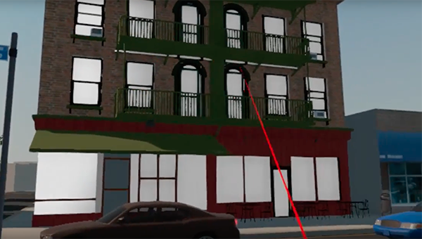
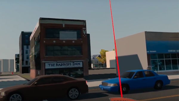
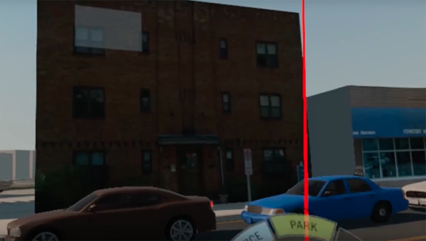
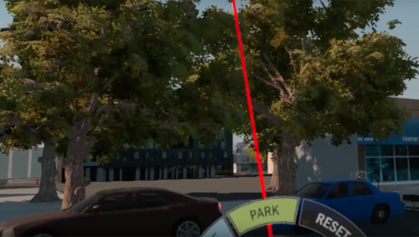
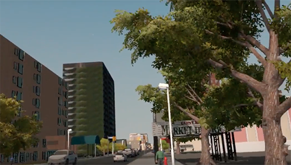
3D Visuals Make It Real
These images show screenshots from the 3D Visualization Software, imagining the same intersection with different types of buildings and/or green space. The user can toggle such options in seconds.
“The biggest impact of the tool will be citizen engagement in the planning process,” said Worley. “Two dimensional maps can be hard to interpret, but a VR tool that can visually display information allows anyone the opportunity to see what impacts proposed developments would have on the urban environment.”
An immersive VR visualization is like a data-driven map you experience from the inside. When trying to get community members to not only understand plans, but to actively engage in the conversation, such a tool has immeasurable value.
So, what is the experience of this software really like? For some users, it may resemble the experience of playing a simulation game like The Sims. Only, instead of interacting with an imaginary universe, the CMU visualization software would let users transform a familiar cityscape—perhaps their own neighborhood!
The software is designed to be extremely interactive and detailed. A user can not only make changes to human-made structures like roads and buildings, they can also change traffic and pedestrian patterns and natural elements like the weather and time of day.
That means you can see what a light rail line might look like in practice, while at the same time checking what the neighborhood will look like at night, or how the addition of some trees will affect shady areas on a hot afternoon.
Best of all, these changes can be made with the click of a button. Rather than having a planner iterate multiple drawings, or looking at a picture and trying to imagine how certain variables will affect the feel of a street, planners and citizens alike can use the VR tool to remake their surroundings instantaneously.
“You can go to a meeting with drawings or data, but participants might not truly understand their meaning or changes to streets, buildings, or other aspects of the built environment,” Kurland told CMU.edu. “But by using 3D software, in some cases similar to that used in the movie industry, you can help them visualize changes and tell a story.”
By applying concepts from film and gaming to urban planning, this innovative project shows what the future of planning and design in a smart city might look like.
Funding for this project is provided by the Deloitte Foundation, the Heinz Endowments, and the Metro21 Smart Cities Institute.